RTS Monitoring
RTS Product Monitoring
The IGS RTS provides access to real-time precise products such as orbits, clocks, code and phase biases, which can be used as a substitute for ultra-rapid products in real-time applications. The true performance of these products can be assessed by the daily statistics derived from the comparison with IGS rapid products.
The current RTS product monitoring is based on comparisons performed by the RTACC. Therefore, the GFZ MGEX rapid products (Deng et al. 2017) with the following satellite clock reference observables
- G: C1W C2W
- E: C1C C5Q
- C: C2I C6I
- R: C1P C2P
are used for monitoring and comparison purposes. In order to satisfy high demands on availability and reliability, the RTACC also provides two combined multi-GNSS product data streams:
- SSRA02IGS/SSRC02IGS (GPS, GLONASS, Galileo)
- SSRA03IGS/SSRC03IGS (GPS, GLONASS, Galileo, Beidou)
For it, a combination technique based on a Kalman filter aproach (BNC), which is able to deal with outages and offsets in the individual RTAC solutions, is used.
In the following, the satellite orbit and clock performance of different constellations is presented for individual RTAC solutions as well as for the combined products over the last 30 days:
GPS: SSRC Streams


GPS SSRA Streams


GLONASS SSRC Streams


GLONASS SSRA Streams


Galileo SSRC Streams
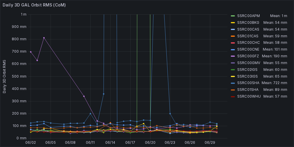

Galileo SSRA Streams


Beidou-3 SSRC Streams


Beidou-3 SSRA Streams


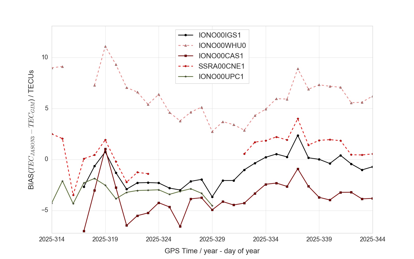
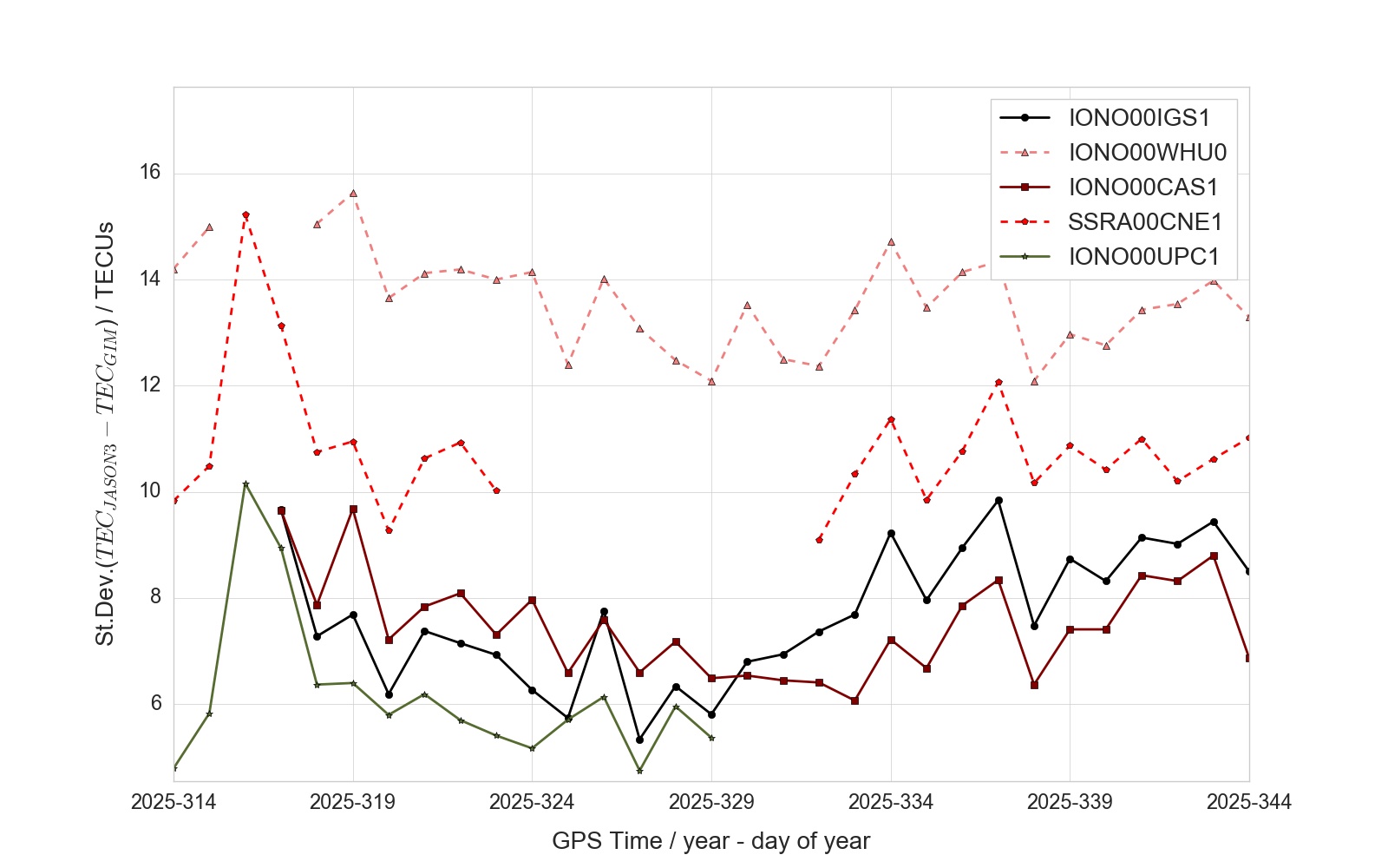
RTS Ionospheric Delay Monitoring
VTEC from global ionospheric maps created in real-time produced by the individual ACs as well as the combination (product stream IONO00IGS1) is compared to a reference ionospheric products based on Jason-3 data. The bias and standard deviation of the ionospheric delay correction products are computed with respect to the reference on a daily basis over the last 30 days and plotted below.
RTS Ionospheric Delay Validation
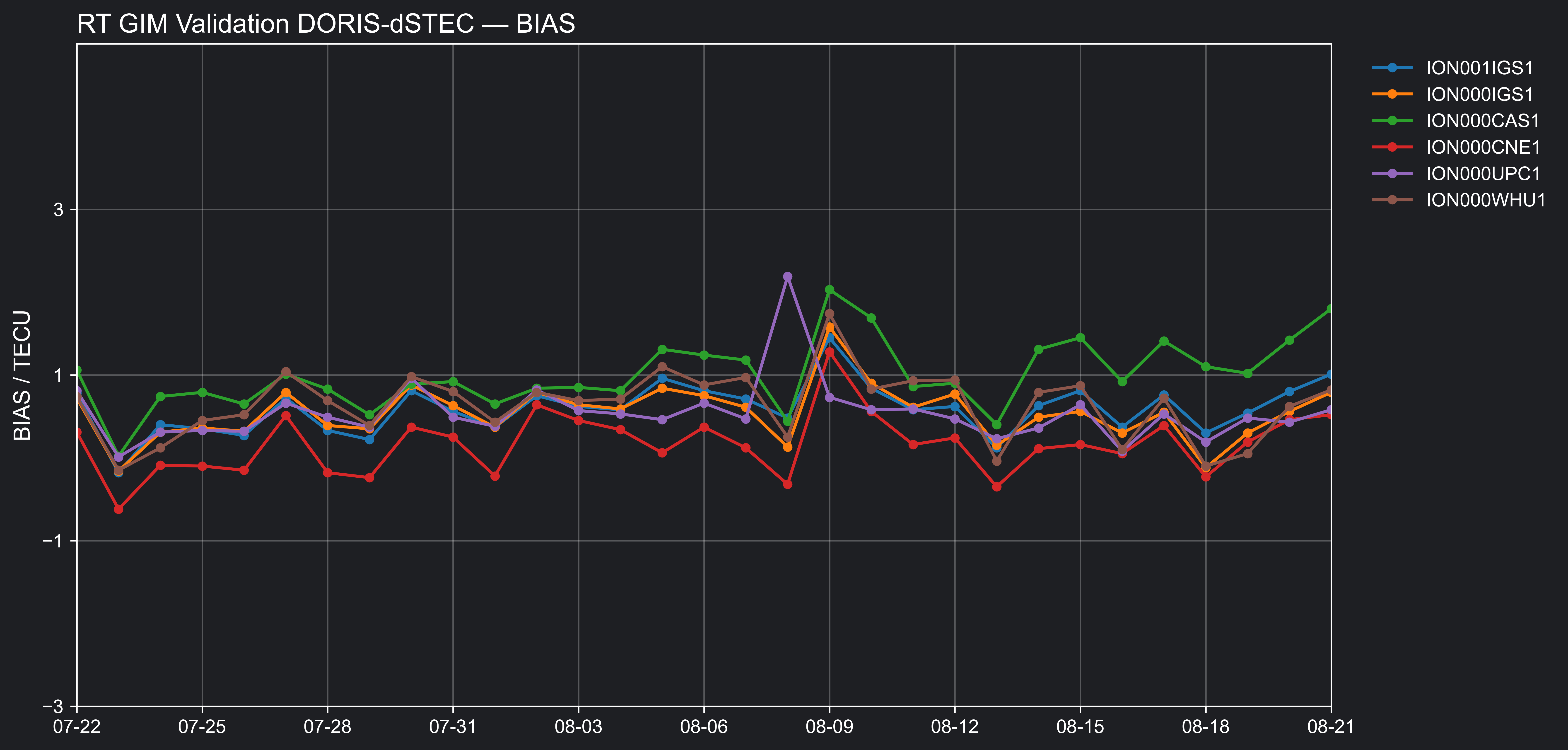
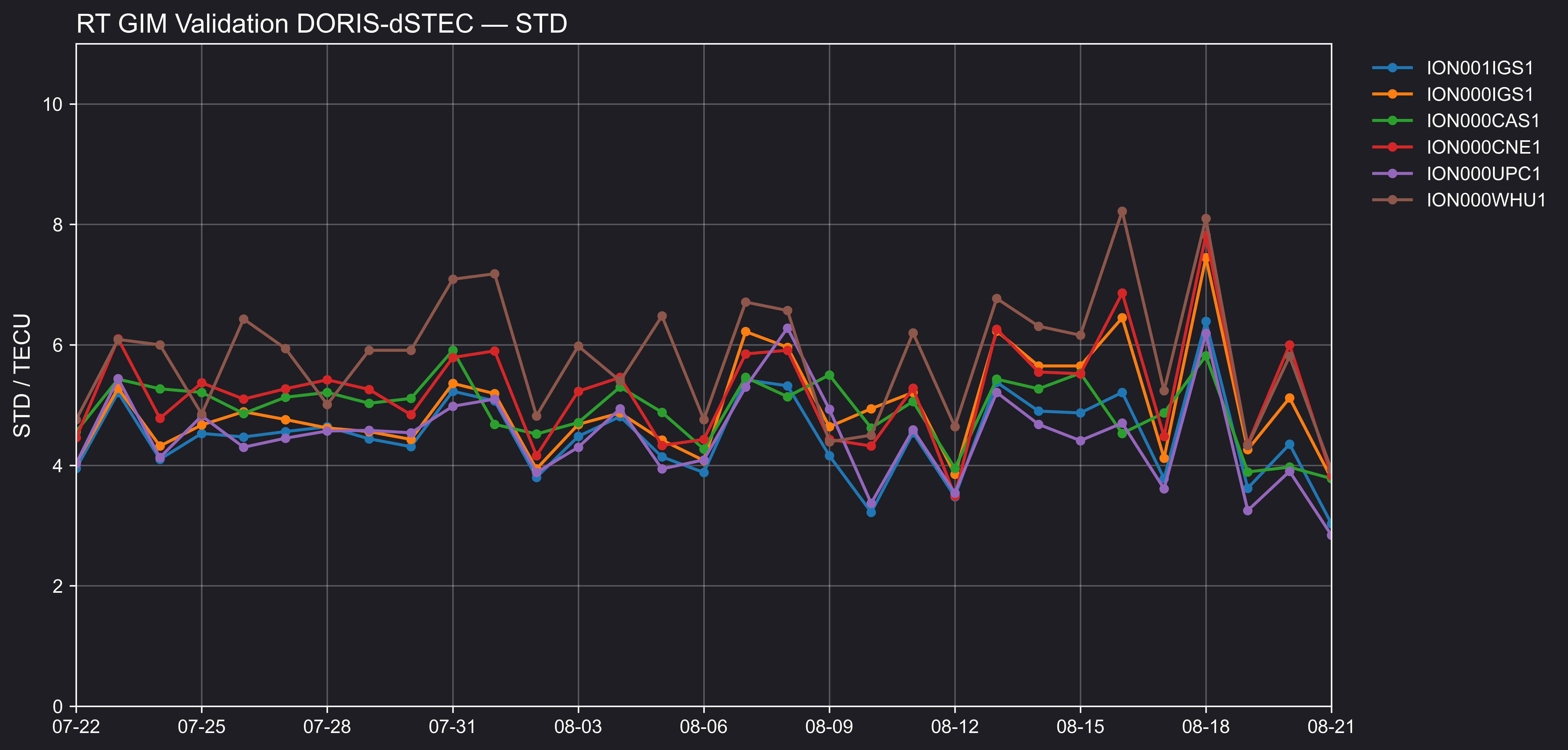
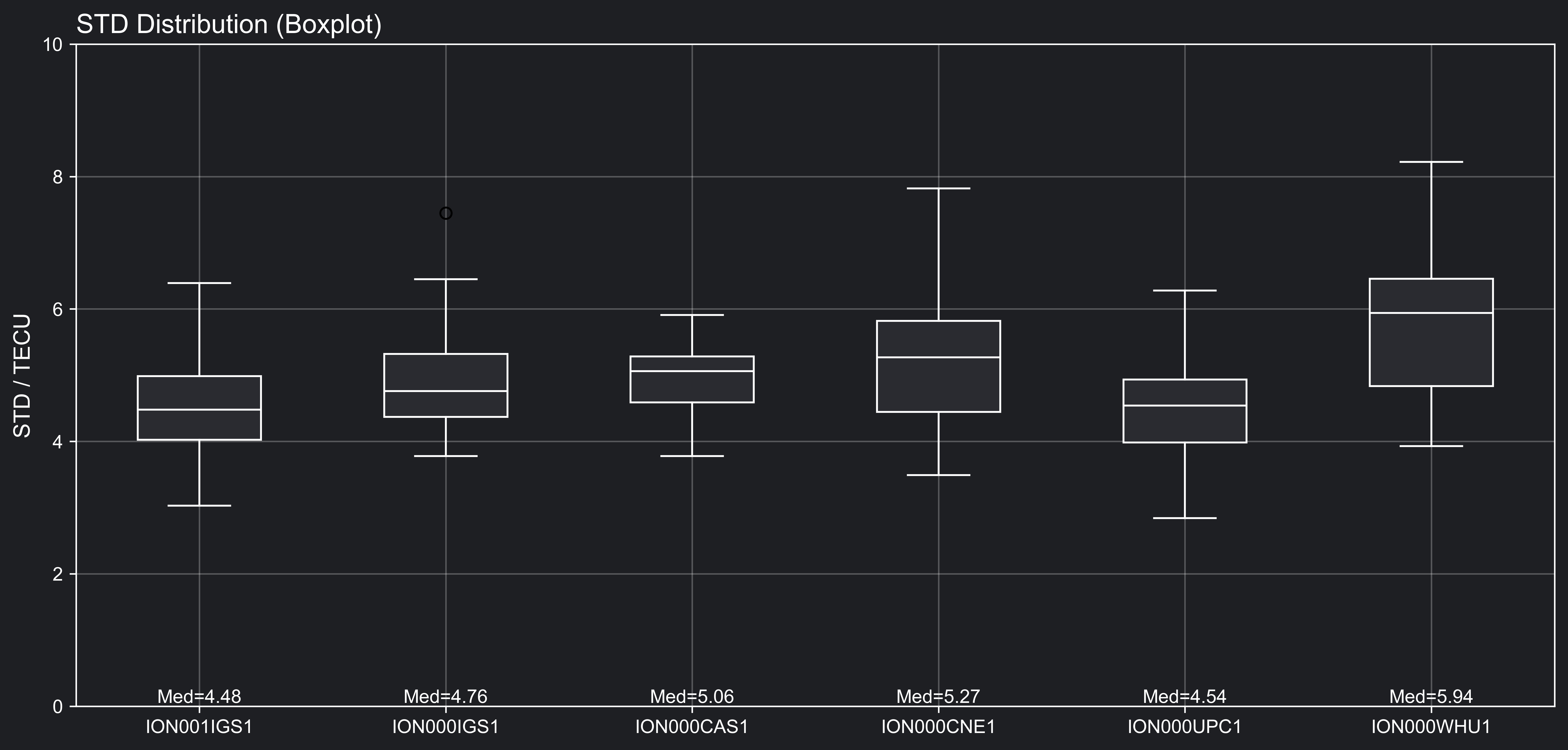
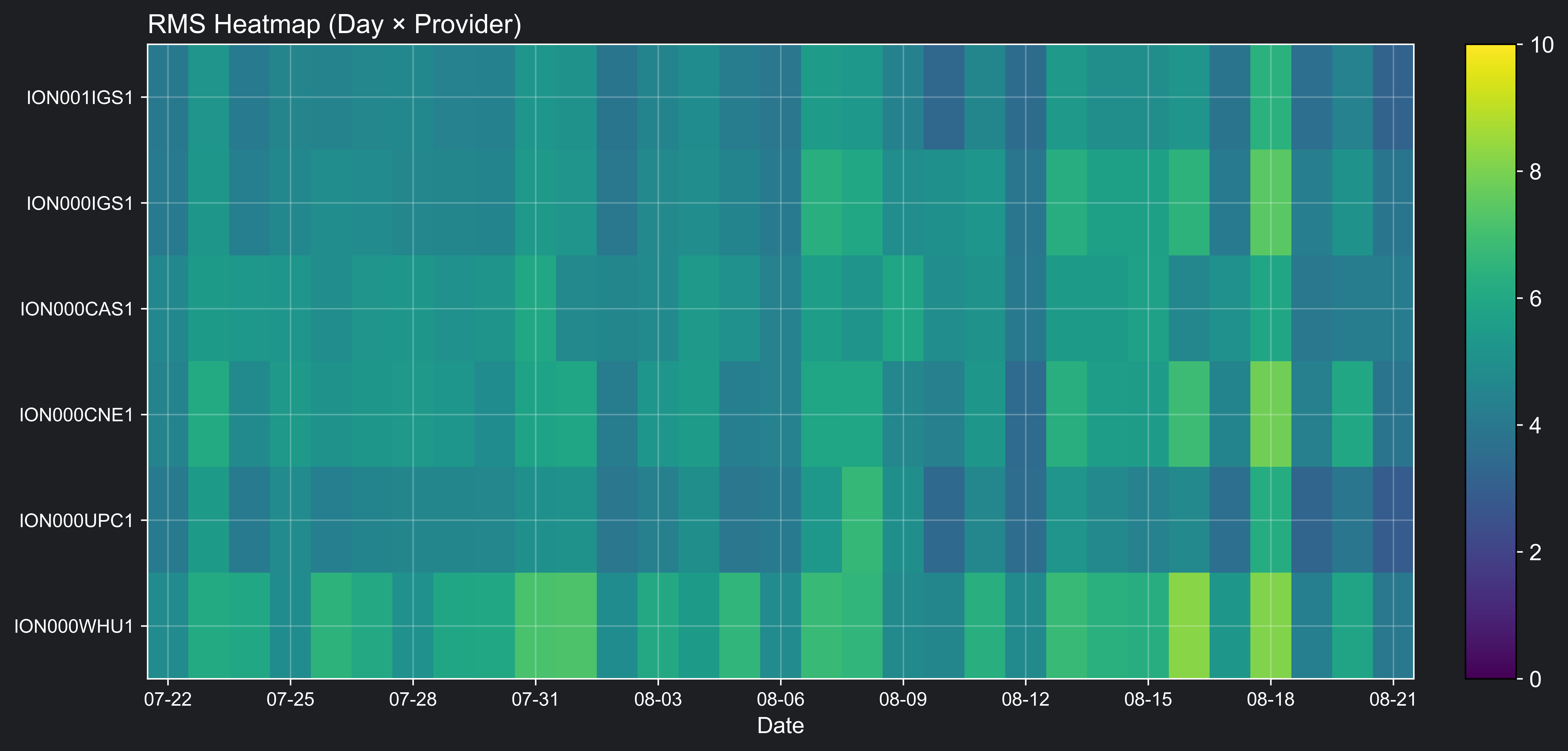
The high-quality dual-frequency phase observations of the DORIS system provide a valuable source of information for global ionospheric analysis. These data are particularly suited for an independent and external validation of existing GNSS-based ionosphere models. For this purpose, relative variations in the slant total electron content (dSTEC) derived from dual-frequency observations are calculated along the link between the ground station and the satellite, with reference to the highest satellite elevation of each pass. This approach has long been applied for GNSS observations (i.e., GNSS dSTEC analysis), and was recently adapted to DOIRS observations by Liu et al (2023), who introduced the concept of DORIS dSTEC, to evaluate real-time global ionospheric maps (RT-GIMs) from different IGS analysis centers.
Using NRT DORIS data from Jason-3, the accuracy of different RT-GIM products are routinely monitored with a latency of about 24 hours. The evaluation includes RT-GIMs from CAS (IONO00CAS1), CNES (IONO00CNE1), UPC-IonSAT (IONO00UPC1), WHU (IONO00WHU1), NRCan (IONOO0NRC0) as well as the IGS combined solutions ION000IGS1 generated by UPC-IonSAT and ION001IGS1 generated by CAS.
Bias and STD time series
STD distribution (boxplot) and RMS heatmap
RTS PPP Performance
As a final performance review from the user perspective, the IGS RTS products were introduced in a Precise Point Positioning (PPP) client engine. Corresponding charts resulting from the combination products are presented here.
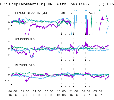
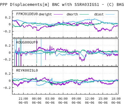
These and in addition the PPP performance resulting from individual RTAC solutions can be found at: https://igs.bkg.bund.de/ntrip/ppp.
Deng Z., Nischan T., Bradke M. (2017): Multi-GNSS Rapid Orbit-, Clock- & EOP-Product Series. GFZ Data Services. https://doi.org/10.5880/GFZ.1.1.2017.002
Liu A., Wang N., Dettmering D., Li Z., Schmidt M., Liang W., Yuan H. (2023). Using DORIS data for validating real-time GNSS ionosphere maps. Advances in Space Research, 72(1), 115–128. https://doi.org/10.1016/j.asr.2023.01.050
Last Updated on 8 May 2026 09:08 UTC